Bicycle and Pedestrian Resources
2025 Kane & Northern Kendall Bike Map Update
Kane County has updated the Kane & Northern Kendall Counties Bike Map and the Kane County Highway Map. The new 2025 bike maps are available to residents free of charge using the order form below.
2025 Kane and Northern Kendall Counties Bike Map To request a printed copy, use submit the order form via email or mail.
2025 Kane County Highway Map
2023 Kane County Bicycle and Pedestrian Plan
The Kane County Bicycle and Pedestrian Plan was adopted by the Kane County Board in 2023.
Kane Kendall Council of Mayors Bicycle and Pedestrian App
The Bicycle and Pedestrian App allows bicycle facility users in Kane and northern Kendall counties to view currently available facilities and amenities. Users can find information on:
- Regional and Local Trails
- Current and Planned Bike Routes
- Trail Surface Type
- Trail Closures
- Bike Shops
- Levels of traffic stress on major roads
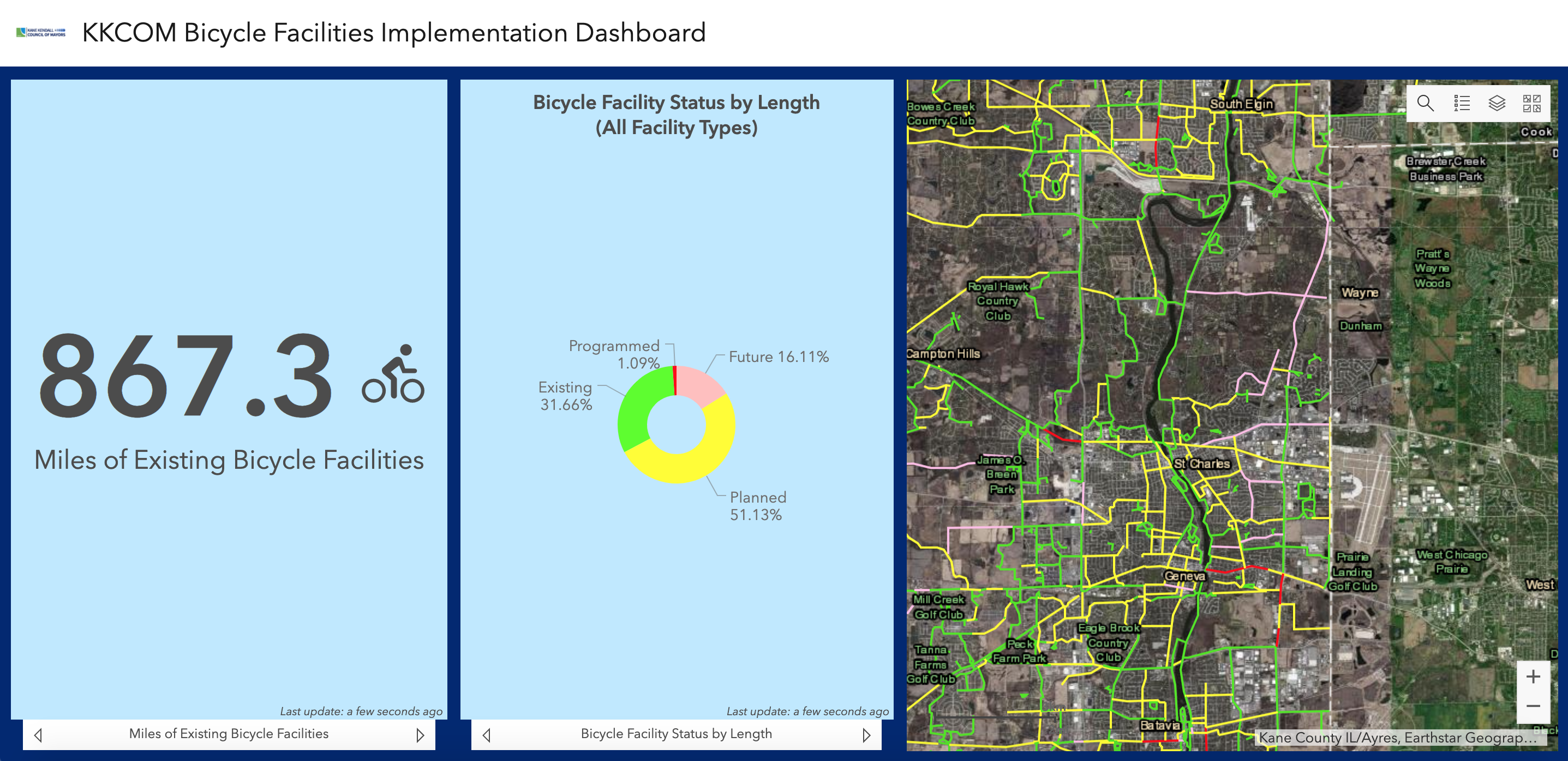
Kane Kendall Council of Mayors Bicycle Facilities Implementation Dashboard
This
dashboard supports one of the objectives of the 2012 Bicycle and Pedestrian Plan to continually update a bikeway GIS database inventory system. The present version of the inventory is composed of local agency plans as well as the Chicago Metropolitan Agency for Planning's Regional Greenways and Trails Plan.
Kane Kendall Council of Mayors Bicycle and Pedestrian Resources
The KKCOM
website contains two sets of bicycle and pedestrian resources, one geared more for
planning purposes and the other for
general information. Information includes maps as well as educational resources and cycling-related organizations.